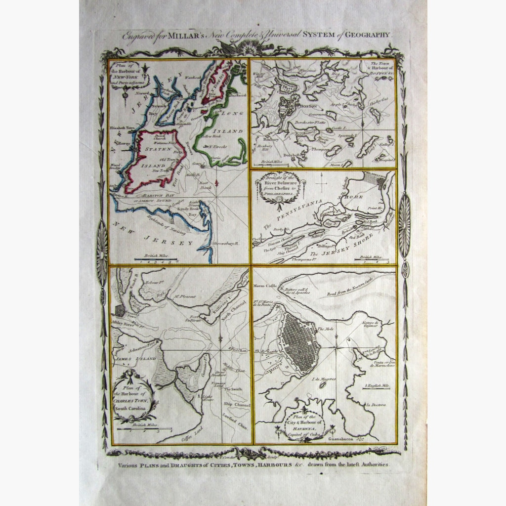
Antique Copperplate, hand coloured map of Various Plans and Daughts of Cities, Towns, Harbours etc. drawn from the latest Authorities.
Showing the following 5 maps, The harbour of New York, the town and harbour of Boston, the plan of the harbour of Charleston, the river Delaware, and the City and Harbour of Havana. These are plans from the American Revolutionary War era.
From Millar's New and Complete System of Geography , 1779
Size 24 x 38 cm. Condition Very Good.