Spain & Portugal Maps
Antique maps of Spain & Portugal. See Spain & Portugal Scenes & Views for landscape prints and genre scenes.

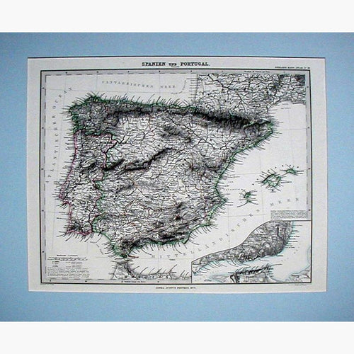


About antique maps of Spain & Portugal
Spain and Portugal have a long and colourful history, which is reflected in the rich selection of antique Spanish and Portuguese maps, prints and charts.
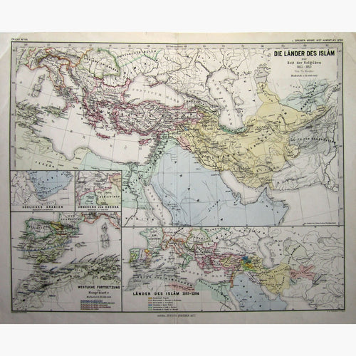
Hispania is the Latin name for the Iberian peninsula, which was under Roman rule from about 200BC. In 711 Muslim forces invaded and in seven years conquered the Iberian peninsula. It became one of the great Muslim civilisations; reaching its summit with the Umayyad caliphate of Cordovain the tenth century. Muslim rule declined after that and ended in 1492 when Granada was conquered.
The Spanish Empire expanded with the colonisation of Central America after the arrival of Chrispher Columbus in 1492
Portugal was named after the city of Porto, whose Latin name was Portus Cale. The Umayyad Caliphate ruled the Iberian Peninsula from 711 until 1249 when the Algarve was recaptured by the Christians. This was the reconquista period. Portugal spearheaded the European exploration of the world under the guidance of Prince Henry the navigator.
The Roman Catholic Church instituted the Inquisition to combat hearsay .Towards the end of the middle ages, persecution of Jewish and Muslim converts to Catholicism was the special concern of the Spanish and Portuguese inquisitions, because of the belief that they secretly practised their old faiths, resulting in cruel methods of torture to extract confessions.