Italy Maps
Antique maps of Italy. See Italy Scenes & Views for landscape prints and genre scenes.


About antique maps of Italy
The very first maps were manuscript maps. Italy was the centre of map making at a very early date.
The Far East was charted by Marco Polo, the East Coast of America by Columbus, Vespucci and Cabot, helped by the bankers and merchants of Genoa, Florence and Venice. The World map of 1306 by Marino Sanudo. 1457-9 Fra Mauro at the convent of Murano near Venice made a map of the world which was 6 ft in diameter. They also made Portolan Charts (sea charts).
This all had to do with Exploration, as without maps and charts they would be unable to find new lands, and trade with other countries. Ptolemy wrote a treatise on geography in circa 3 A.D.The first map after Ptolemy was printed in Bologna in 1477. This period of great Italian map making came to an end in 1570 with the advent of Ortelius and Mercator etc.
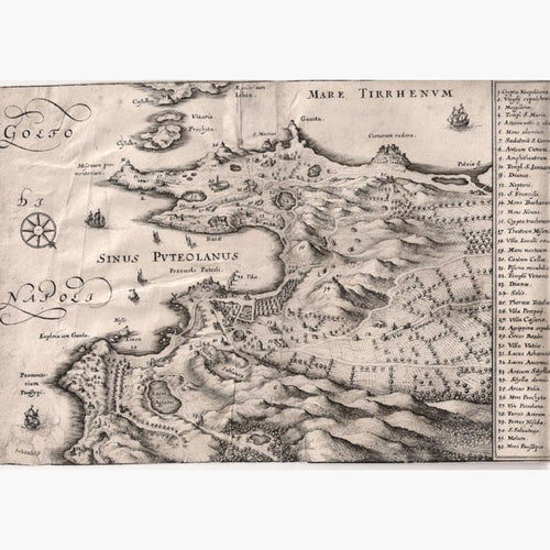
However I have very interesting maps such as The Gulf of Neapoli 1688, Hannibal's route over the Alps in 1760, and more.