Austria Maps
Antique maps of Austria, the Austrian Empire and the Austro-Hungarian Empire. See Austria Scenes & Views for landscape prints and genre scenes.


About antique maps of Austria
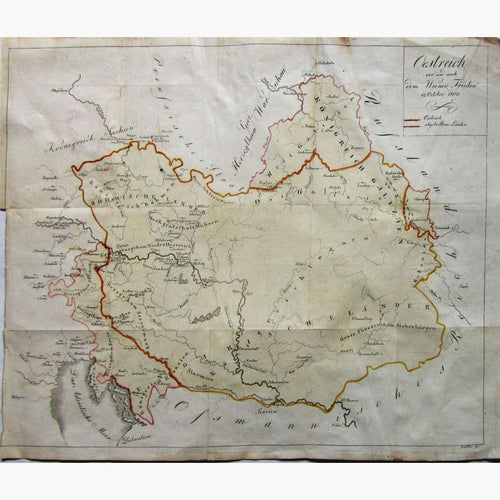
During the 17th and 18th centuries, Austria became one of the great powers of Europe. It was geographically the second largest country in Europe after the Russian Empire. It was multinational, comprising of Lower Austria, Upper Austria, Salzburg, Styria, Carinthia, Carniola, Trieste, Illyria, Tyrol and Vorarlberg, Bohemia, Moravia, Silesia, Galicia, Bukowina, and Dalmatia, Hungary, Transylvania,Croatia, and Slavonia. After the coronation of Napoleon as the Emperor of the French, the Austrian Empire was officially proclaimed in 1804. Following Napoleon’s defeat, Prussia emerged as Austria’s chief competitor for rule of a larger Germany. The Austro-Prussion war ended with the peace treaty of Prague in 1866. Since 1867 Austria and Hungary have been two distinct kingdoms, ruled by the German house of Hapsburg. This lasted until 1918. The Austrian Empire was forced to cede most of its claim to Lombardy- Venetia to the kinkdom of Piedmont- Sardinia following the conclusion of the Second Italian War of Independence in 1859 and the third in 1866.
Franz Joseph I or Francis Joseph I was Emperor of Austria and Apostolic King of Hungary from 1848 until his death in 1916. From 1 May 1850 until 24 August 1866 he was President of the German Confederation. he was troubled by nationalism during his entire reign. In 1867 he granted greater autonomy to Hungary which then became the Austro-Hungarian Empire under his dual monarchy. On 28th of June 1914 the Archduke Franz Ferdinand of Austria was assasinated in Sarajevo by a Bosnian This started the First World War. The immediate cause for the war was tensions over territory in the Balkans.