Antique Map, United States to show Territorial growth, 1910 – KittyPrint
United States to show Territorial growth 1910 Maps KittyPrint 1900s Canada & United States Civilizations & Empires

Antique Map, United States to show Territorial growth, 1910

Regular price £25.00 Sale

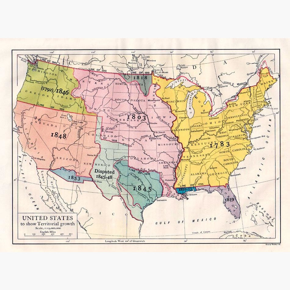
The Coloured map shows the acquisition of territory from 1783. 
Engraved by Emery Walker, from “The Encyclopaedia Britannica, a Dictionary of Arts, Science, Literature and General information,” 11th Edition, Published in Cambridge at the University Press, 1910.

Size 29 x 22 cm. Condition good.


Recently Viewed

Sale

Unavailable

Sold Out