
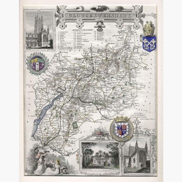
Antique Map, Gloucestershire by Thomas Moule, 1840
Regular price
£65.00
Sale
Highly decorated steel engraved map, hand coloured, with illustrations of Gloucester Cathedral, Tewkesbury Abbey Church, The New Spa Cheltenham, with people drinking the waters. There are Heraldic Shields, an ornate title,and it even shows railway stations.
The map was created by Thomas Moule (1784-1851) He is well known for the decorative but very detailed county maps, which he embellished in his own fashion. All his maps are decorated with the heraldic shields of each county. He was very interested in History, and even wrote a book about fish in Heraldry.
The map is from “Barclay’s Universal English Dictionary,” published by George Virtue, circa 1840.
Size 21.5 x 26 cm. Condition Good.