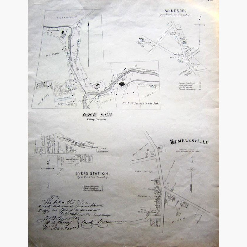
Township Map 1883. Officially Endorsed Map of Valley, Upper Uwchlan and Franklin Townships,
Showing Rock Run, Windsor, Byers, and Kemblesville.
Very interesting map showing Frame buildings, Stone buildings, Barns and Outbuildings. The names of the landowners are noted, as are other features, such as Rolling Mill,Lumber yard, Hotel and Stores.
Scale 20 Perches to one Inch, and 400 feet to the inch. The map is officially endorsed by three County Commissioners..
Size 38 x 51 cm. Condition Good.