Regular price £250.00 Sale
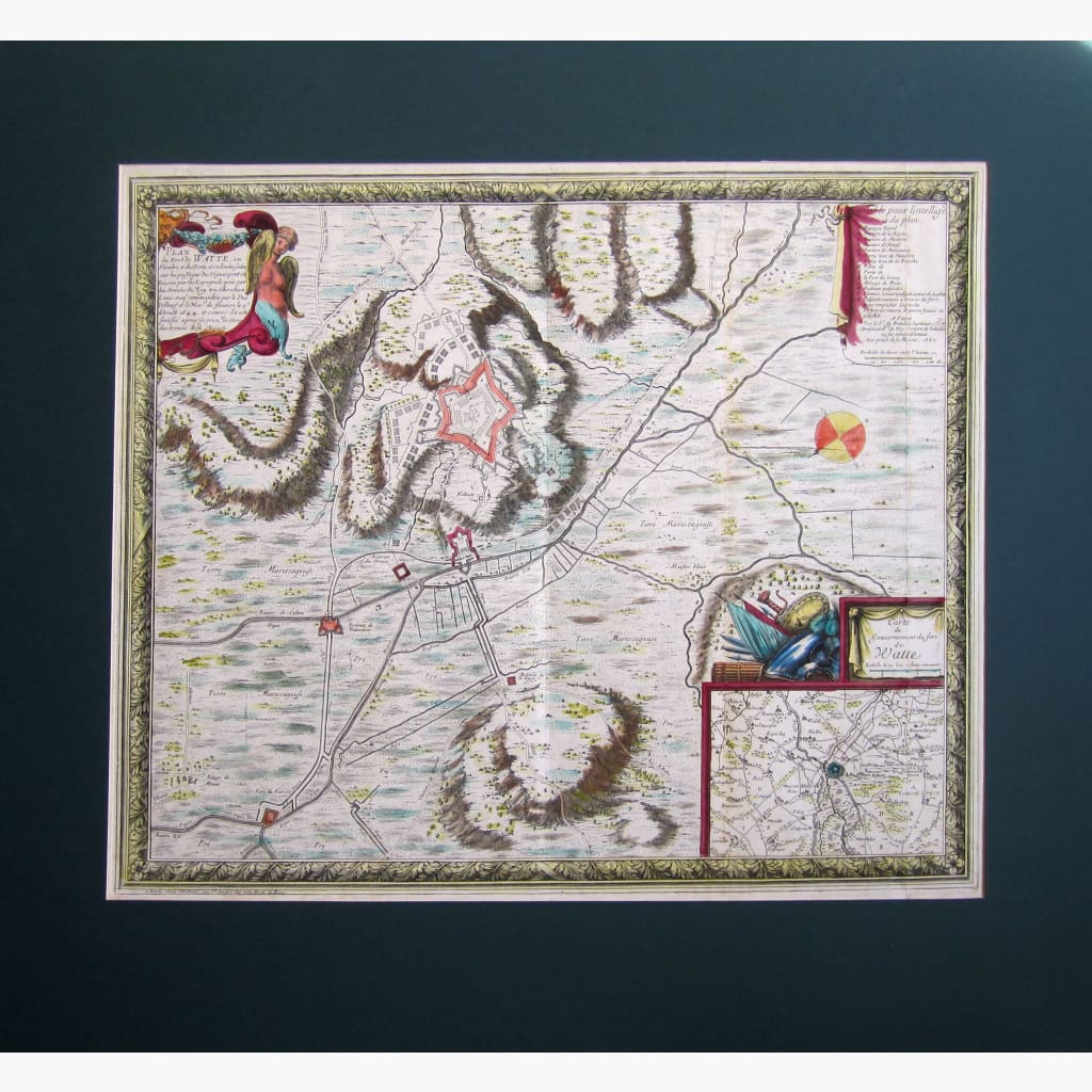
Antique Map, Plan of the Fort of Watte.Copper plate map, contemporary colour, by Sebastien de Pontault, Sieur de Beaulieu, from Les Gloriuses Conquestes de Louis Le Grand Roy de France et de Navarre, 1694.
Size 54 x 45 cm. Condition Good.
Unavailable
Sold Out