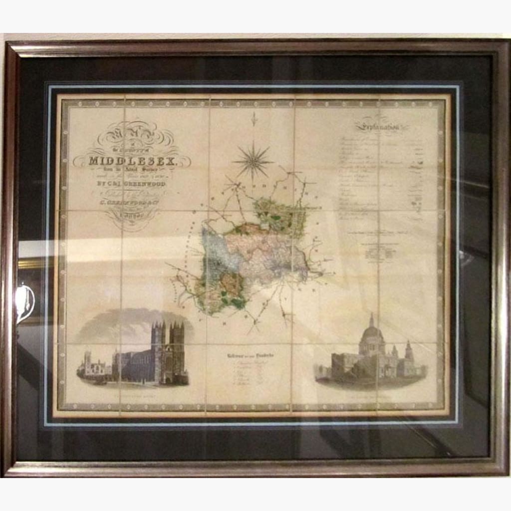
Map of the County of Middlesex from an actual Survey made in the years 1819 and 1820 by J. and I.Greenwood.
Christopher and John Greenwood were brother cartographers who produced large-scale maps, of one inch to the mile, of England and Wales.
The Framed map is a steel engraving, wash coloured across the body of the map, decorated with large vignettes of west front of Westminster Abbey and north side of St. Paul’s Cathedral, both drawn by R. Creighton The Cartouche is very ornate.
Size 87 x 76 cm framed and glazed. Condition Good.